


Touristik Verlag
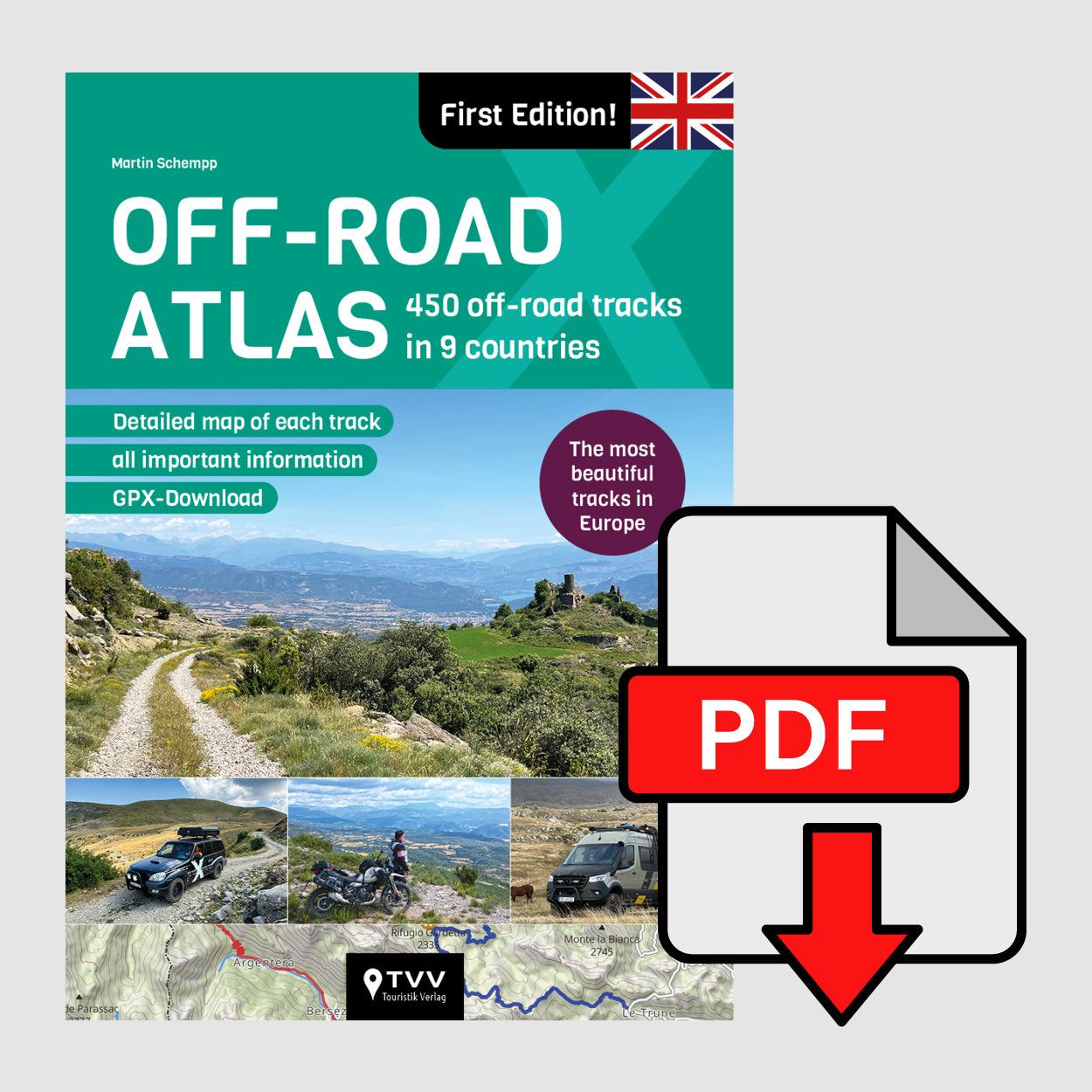
Off-Road Atlas - english edition - EBOOK (PDF)
Off-Road Atlas - english edition - EBOOK (PDF)
Digistore24 handles payment, invoicing, taxes and delivery of the e-book as a PDF file!
Our successful Off-Road Atlas is finally available in English! It now features 450 off-road tracks with important information, brief descriptions and pictures. By popular demand, information on suitability for different vehicle classes is now also included.
Overview of features:
- ✓ 450 Trails
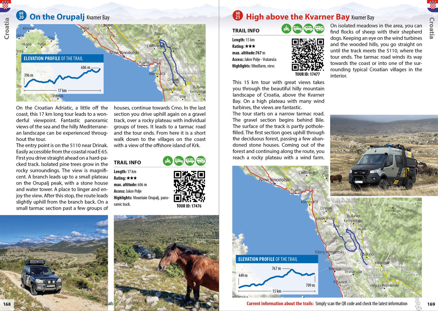
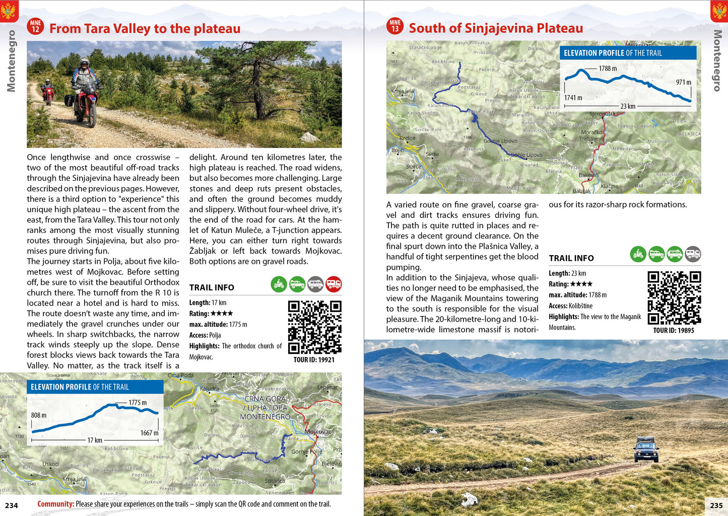
- ✓ There is a map for every off-road trail.
- ✓ Detailed and informative route descriptions
- ✓ New: Suitability classification according to vehicle types
- ✓ Information on the difficulty level and elevation profile of each slope
- ✓ photos of the individual routes
- ✓ GPX-Tracks für jede Offroad-Piste, einfach per QR-Code herunterladbar
Which countries are included?
Which countries are included?
Discover trails in the following countries:
- Germany
- Austria
- Slovenia
- Croatia
- Montenegro
- Albania
- Italy (Northern Italy)
- France (Western Alps and Pyrenees)
- Spain (Pyrenees and Northern Spain)
There are many off-road tracks in Europe that are legally accessible. Whether you're travelling on a touring enduro, an off-road vehicle or an expedition vehicle, you're guaranteed to find the right off-road route for your individual tours in our Offroad Atlas. Our scouts have tested and mapped the most interesting off-road routes in Europe for you.
How can I download the GPX data?
How can I download the GPX data?
Simply scan the QR code contained in each route description in the info box with your smartphone. This will take you to the GPX download. Alternatively, enter the TOUR ID contained in each route description below the QR code at www.offroadatlas.de. The GPX data can only be downloaded individually; a file containing all GPX tracks is not available!
Are TET or ACT tracks also included?
Are TET or ACT tracks also included?
Some sections of the TET and/or ACT also run along tracks that are included in the Off-Road Atlas. However, the tracks listed in the Off-Road Atlas go far beyond the shared sections. On the other hand, not all off-road sections included in the TET or ACT are described in the Off-Road Atlas.
Share
The Off-Road Atlas is interactive!
The integrated QR code for each tour is interactive in this atlas, allowing direct access to GPX data. This makes it easy to download tracks, follow them and even add your own comments. The atlas also offers an interactive platform where off-roaders can share their experiences and benefit from tips from other travellers. This allows users to share the latest information about trail conditions or new closures.
Alternatively, all GPX tracks for the trails can be downloaded free of charge for navigation devices at www.offroadatlas.de. Simply enter the tour ID in the search window.
We need your help!
Your comments, photos and valuable tips about the trails are very important to us. Every contribution counts in our efforts to continuously improve the Atlas and make it as informative and useful as possible.
Simply use the QR code in the info box of each route description, which you can scan with your smartphone. This not only gives you access to the GPX data for the respective route, but also allows you to share your own experiences with the community and benefit from the latest information. Alternatively, you can also enter the TOUR ID on our website www.offroadatlas.de. Your active participation makes our atlas a lively and growing project.